
Map of the gorge
Location
Rychlebské hory, Nýznerov
Navigation in Mapy.cz
Navigation in Mapy Google
Time: 6:00h
Ascent: 3:00h
Descent: 3:00h
Difficulty
Elevation difference: 650m
Discovered for rokling.cz by Průzkumníklára.
Trail description
The road starts at the Skorošice Museum, you can park comfortably here. From there, continue for about 1.2km and then climb up the bed of the Stříbrný (= “Silver”) Brook.
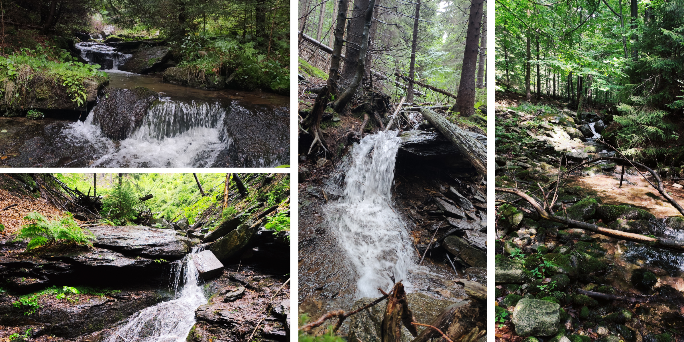
After a while you will come across the beautiful Nýznerovské waterfalls, which are also a natural monument. A set of cascades and rapids above the mouth of the Bučinský brook make a truly romantic place. The lower part of the waterfall flows through a narrow rock gorge, but the upper part is accessible by a staircase. The water falls in steps to a depth of 14 m and the highest step reaches almost 3m.
From the waterfalls, continue along the bed of the Bučinský Brook for about 400m and you will come across another beautiful place – Bučinské Falls. The waterfall is approximately 3.5m high. Continue on, the trail gets steeper and the stream gets stronger, but the scenery is still beautiful. Beech and spruce forests surround the stream bed and provide shade on hot days.
The path is rounded off by two wells of the Bučinský brook. From here you can descend along the green hiking trail, or you can extend your journey to the top of Smrk Mountain and from there descend along the yellow and then the blue hiking trail.