
Map of the gorge
Location
Bílý potok, Vidly
Navigation in Mapy.cz
Navigation in Mapy Google
Time: 6:05h
Ascent: 3:10h
Descent: 2:55h
Difficulty
Elevation difference: 540m
Discovered for rokling.cz by Průzkumníklára.
Trail description
The route starts from the parking lot Bílý potok, which is free of charge and you can leave your car there. In case of full occupancy, you can leave your car a little further at a tourist shelter. Parking is allowed at both locations.
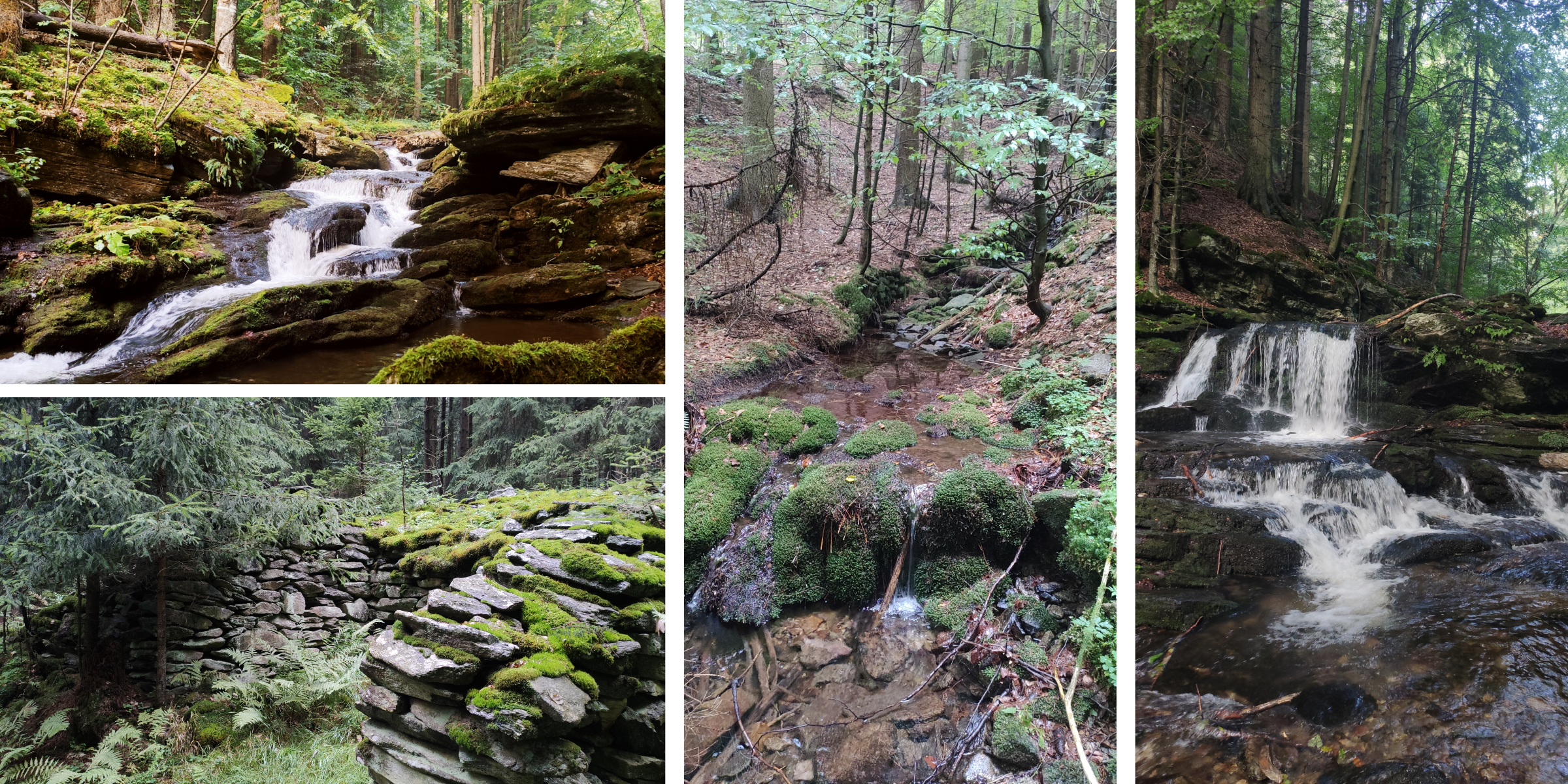
From the car park, follow the main road for a short distance and at the next turning turn right onto the asphalt road and after a while you can continue along the bed of Skalní potok (= “Rocky Brook”). The first part of the gorge passes through the Skalní Brook Nature Reserve, please behave and remember this. The nature reserve was declared in 2001 to protect the virgin forest vegetation, which provides a refuge for many species of rare plants and birds. The subject of protection is the common yew, and the plants protected include the bird’s-nest orchid and the spring figwort. A number of bird species, such as the eagle-owl, black stork or even the peregrine falcon, come here to hunt, and the lynx lives here, too.
The bed of Skalní Brook is surrounded by a large number of rocks and cliffs, which give birds a large space for nesting. The water is slower at the beginning, but gradually gains strength and forms cascades and waterfalls. After about a kilometre you will come across the first big waterfall – the waterfall of Skalní Brook. It is a 2m high waterfall and a series of cascades surrounding the largest arm. Another beautiful waterfall follows a few hundred metres upstream. Continue higher, and if you are observant, you will notice traces of the flickers and woodpeckers that abound here and nurse the forest back to health.
The creek is made up of many pools and ponds, no harm in packing your swimsuit! Watch out for fallen trees, which block the gorge. Children will make a climbing frame out of them, but after rain the path can be dangerous. Little observers and nature experts will notice the lichen growth on the trees from one specific cardinal direction.
From the spring of Skalní Brook, head up before you hit the yellow hiking trail and continue up to Ztracený vrch (= “Lost Hill”). From Ztracený vrch, take the blue hiking trail all the way to the “Lysý vrch” crossroads. A short distance from Ztracený vrch, there is the Kamzičí skála (= “Chamois rock”), which also provides a very beautiful view.