
Map of the gorge
Location
Loučná nad Desnou, Kouty nad Desnou
Navigation in Mapy.cz
Navigation in Mapy Google
Time: 5:00h
Ascent: 2:35h
Descent: 2:25h
Difficulty
Elevation difference: 910m
Discovered for rokling.cz by Průzkumníklára.
Trail description
From the bus stop “Loučná nad Desnou, Kouty nad Desnou, pošta” continue along the asphalt road to the signpost “Knížecí cesta” (= ”The Prince Road”), here you can enter the riverbed of the Hučivá Desná, which gradually turns into the Poniklý potok stream. At the beginning, the riverbed is wide, then becomes narrower and very rocky.
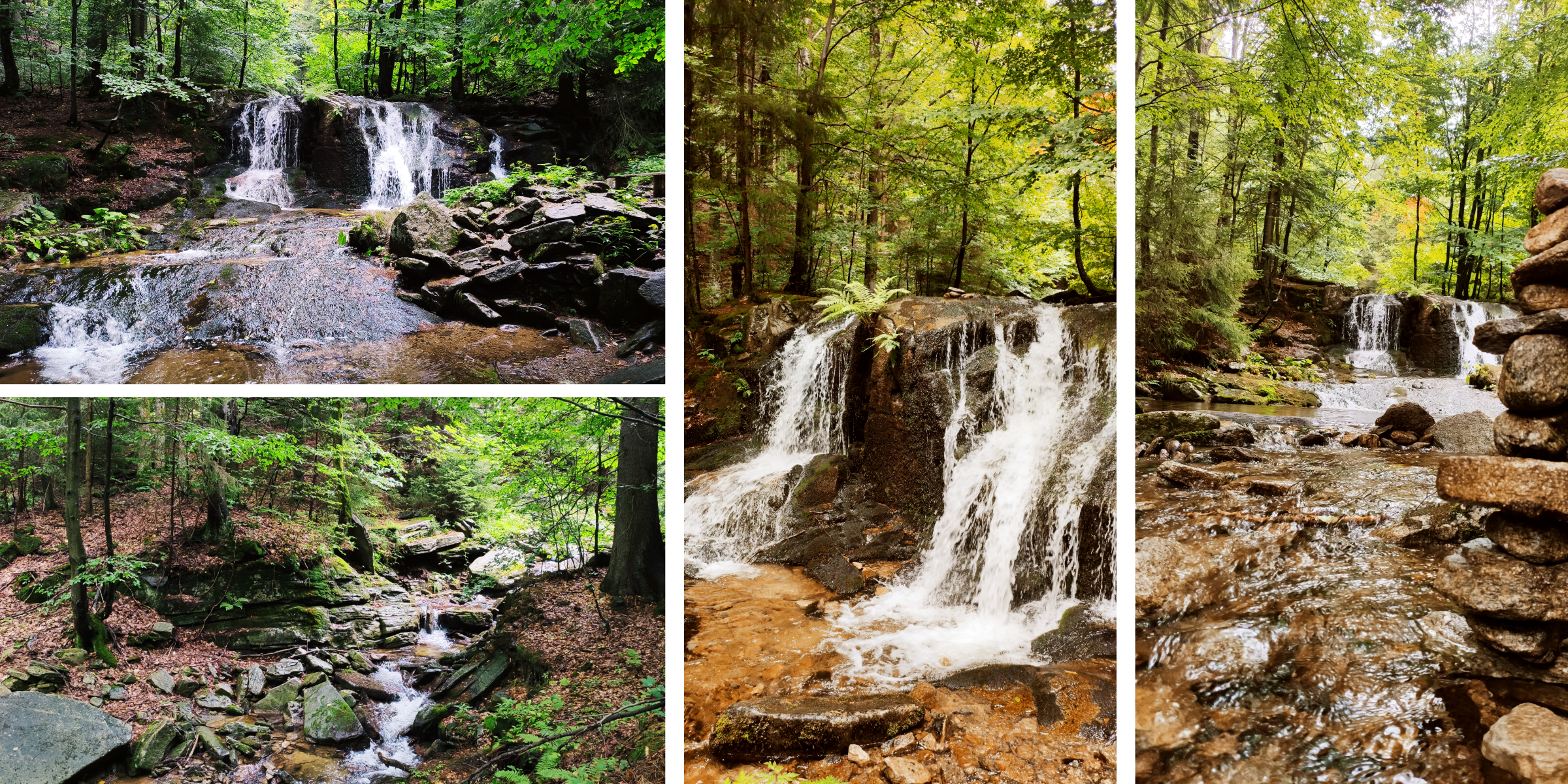
After about 500 metres you will meet a dam. Watch out for obstacles in the form of fallen trees and logs. The channel is filled with large boulders on which the water bounces. The creek has many nooks and crannies, and the mixed forest of beech and spruce provides pleasant shade. Around the stream there are many rocks and large boulders that look more like stone plains. You can also see semi-collapsed dams and man-made cellars. If you are observant, you will also see woodpeckers, there are a lot of them around the gorge. The higher you get, the more the creek narrows and makes curves and meanders as the water finds its way through the hard surface.
After about 2 kilometres you come across Poniklý waterfall. This is truly a beautiful natural formation. The waterfall is very accessible and has two arms that are separated by a prominent rock headwall. The left arm is larger and has more water flowing through it. The right arm is steeper. The height of the waterfall is about 3 metres and up to 120 litres of water per second flow through it! Further above the waterfall we can find other small cascades and waterfalls, but none of them are as massive as the Poniklý waterfall.
Behind the waterfall, you can see a special protected tree. It is a massive spruce with a circumference of almost 400cm. The estimated age of the tree is somewhere between 160 and 210 years. With a height of 37 metres, the volume of its wood is up to 17m³.
And if you continue on, you can refresh yourself at the Poniklá studánka natural well. The well is under the administration of the Hydrometeorological Institute, so the water is safe and tastes really good! Take a right at the crossroads of the streams. If you have time left, you can go back and explore the left side, both are beautiful.
Follow the Poniklý Brook to its source, where you can refresh yourself at the Furmanka well. From there, continue about 800 metres to Spálený vrch (= “The Burnt Hill”), which, by the way, is one of the sites selected for the construction of a pump storage plant. From Spálený vrch go to the peak of Vozka and from there descend along the green hiking trail to the finish.