
Map of the gorge
Location
Bělá pod Pradědem, Domašov
Navigation in Mapy.cz
Navigation in Mapy Google
Time: 7:40h
Ascent: 4:45h
Descent: 2:55h
Difficulty
Elevation difference: 1270m
Discovered for rokling.cz by Průzkumníklára.
Trail description
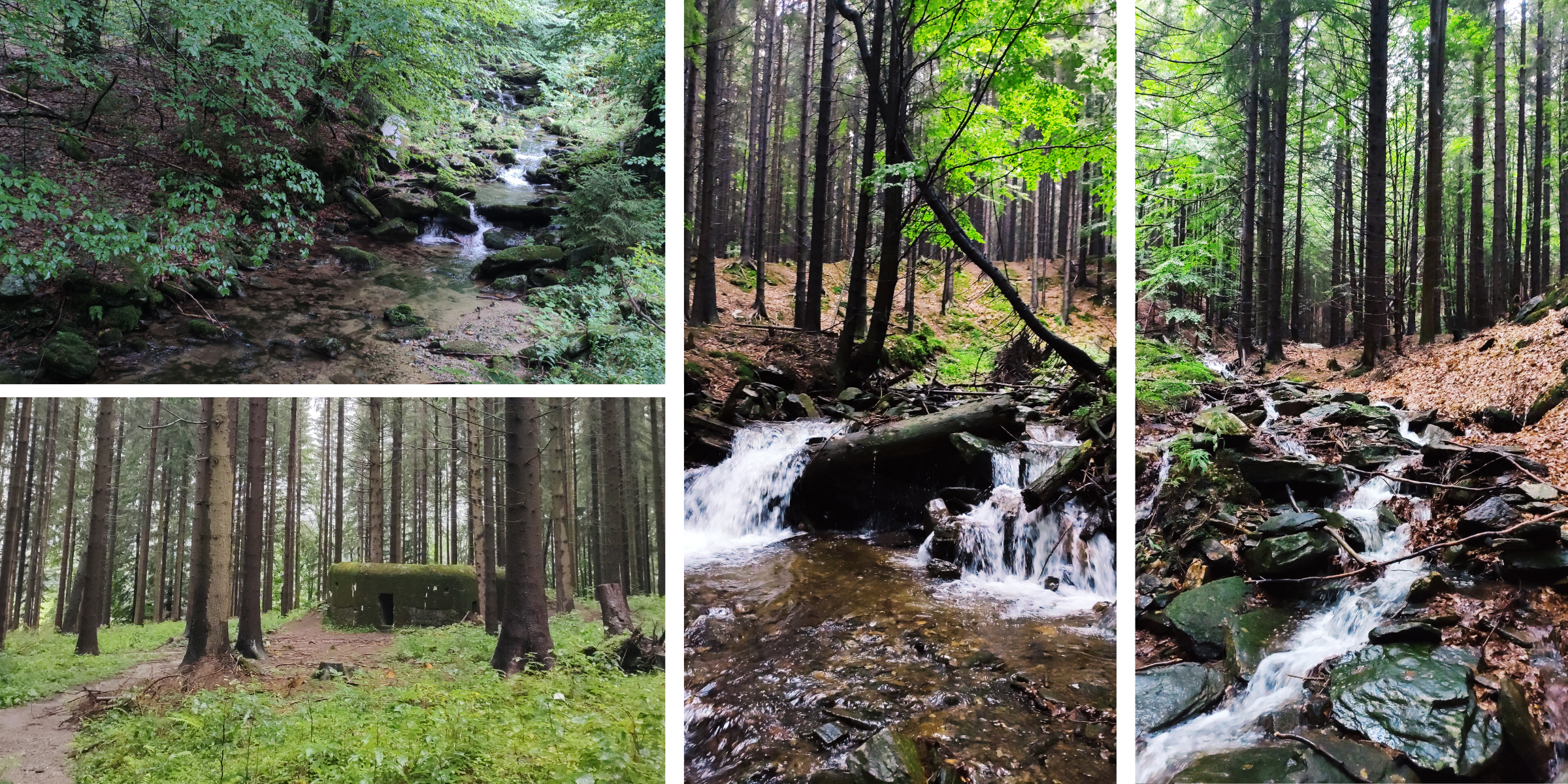
The route starts at the bus stop “Bělá pod Pradědem, Domašov, ObÚ”. From there, follow the asphalt road for about 800m and then enter the bed of the Keprnický Brook.
The stream bed is wide at the beginning, but gradually narrows and the water gains strength and speed. Further on, the landscape is completely untamed and wild. The water jumps over boulders and stones and forms bends. On the left side of the creek, you will see a bunker from the time of general mobilization during World War II, in 1938. These bunkers are called “diggers” and you can see plenty of them around the Jeseníky Mountains. At the crossroads of the watercourses, turn right along the Keprnický Brook and continue to its source. You will pass a forest cemetery and the rocks of Výrovka and at Bysterská chata cabin turn left along the Bysterský Brook, where you can see beautiful waterfalls.
There are a number of waterfalls and cascades and flood defences on the stream. But a tour of the waterfalls only makes sense if there is enough water. The first waterfall is a few dozen meters below the road and is about 5m high. It is followed by a slide and small waterfalls. Follow the same path back to the bed of the Keprnický Brook and continue higher.
You will pass the Šumárník Nature Reserve on your right. The Šumárník Nature Reserve is situated on the rocky peak of Šumný at an altitude of 1073m above sea level and consists of an important botanical locality of a rock outcrop, the protected flowers here are the evergreen saxifraga, the Austrian buttercup and the green spleenwort. There are about 220 plant species registered here, 9 of which are highly endangered. Also worth mentioning is definitely the rock marrow, which is a species of liverwort that is very similar to mosses. The Šumný peak is the only place in the Czech Republic where we can see the rock marrow.
Continue higher to the “Bystrý potok” fork, but since the peak is already in the National Nature Reserve, you will have to return before reaching the spring. Follow the blue hiking trail to the fork and then follow the redhiking trail to the top of Keprník Mountain.
From the top of Keprník descend along the ridge (red hiking trail) to “Sedlo pod Vřesovkou”, here you will turn off to the yellow trail and at the fork “U kamenného okna” you will continue along the green trail over the rocky peak Točník to the finish.
Recommendation
The waterfalls of Rudohorský stream are a very interesting spot too.