
Map of the gorge
Location
Krupka, Unčín
Navigation in Mapy.cz
Navigation in Mapy Google
Time: 7:30 h
Ascent: 4:30h
Descent: 3:00h
Difficulty
Elevation difference: 440 m
Discovered for rokling.cz by Pavel Šimko.
Trail description
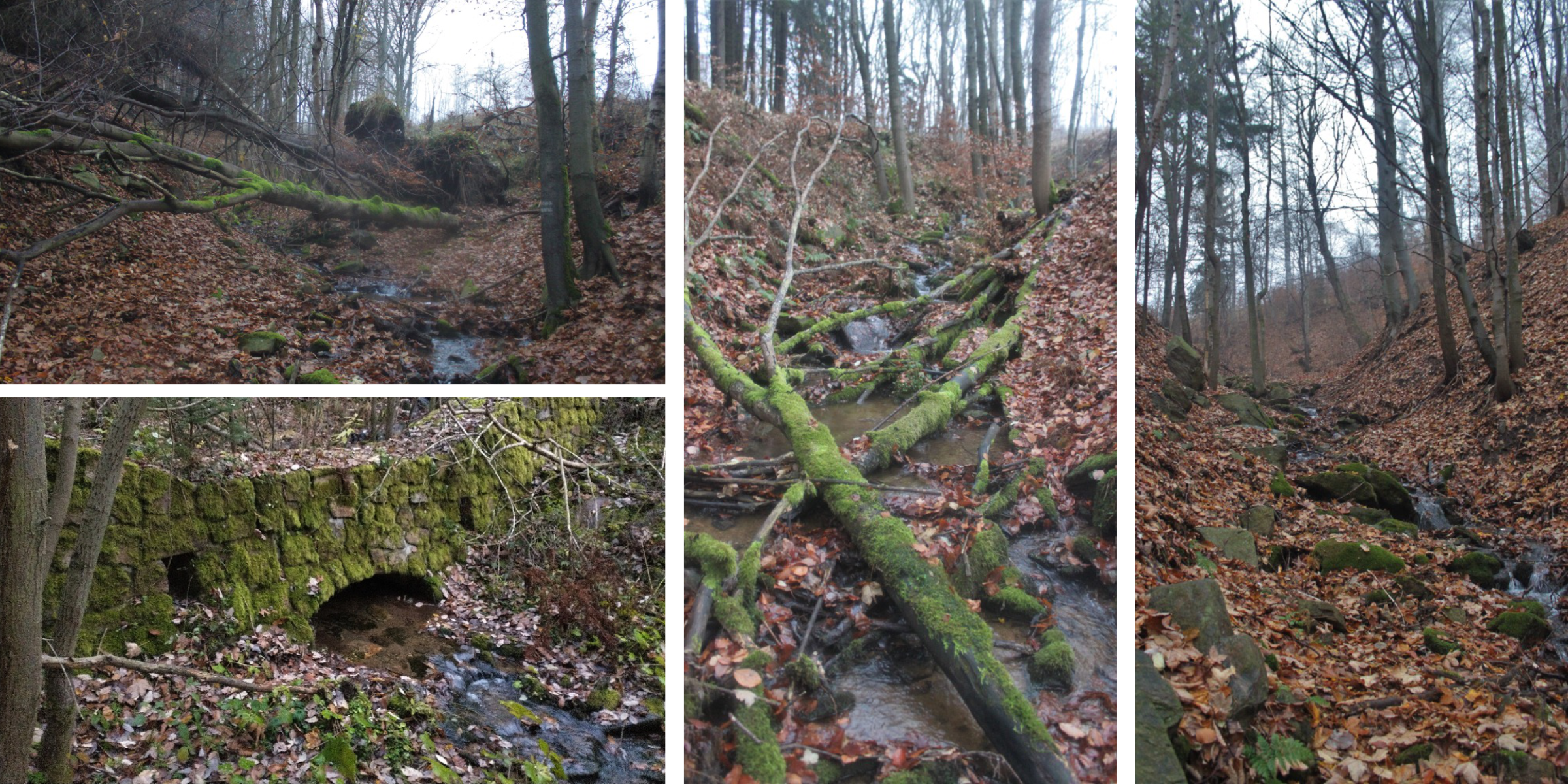
The route starts in Unčín (part of town Krupka), just below the Mlejn restaurant. From the beginning it leads along an asphalt road that enters the valley of the Maršovský Brook. It passes under the ruins of Kyšperk Castle and at 435m above sea level it leaves the asphalt road, which turns to the right. However, our route continues straight through the valley. At 480m above sea level the route leaves the path marked on the maps and continues northwards over the left bank upstream of the Maršovský Brook.
The higher the trail climbs, the less noticeable it is in the surroundings. At approximately 545m above sea level, the route changes to the right bank of the stream. At 580m above sea level, the route enters the stream bed in full. Here the valley narrows significantly and you have to jump from one bank to the other. At the forest boundary the valley loosens, but the stream still cuts steeply into the landscape. Here, the route can continue either directly along the stream or just above the left bank upstream.
At 710m above sea level, the route leaves the stream completely and follows it upstream over the escarpment on its left bank. Here the route enters the area of Supí pláň (“The Vulture Plain”) at the ridge of the Krušné hory mountains. At an altitude of 750m, the trail still passes through the spring and wetlands of the Maršovský Brook, after which it enters a meadow path, and then it is just a short walk to Schenker’s Cross.
Recommendation
From the Schenker’s Cross you can return along the red hiking trail to the Fojtovická pláň crossroads, from where you will descend along the blue hiking trail almost to the ruins of Kyšperk Castle. At 590m above sea level, near the rock of Kateřina Míšenská, you will leave the blue tourist marker and descend back to the valley of the Maršovský brook.
Before you start descending into the valley, I recommend walking to the ruins of Kyšperk Castle, which is just a short distance away. In the valley, you will then descend to the path you started your ascent on at 450m above sea level and return to the starting point.
However, as the ascent through the valley of the Maršovský stream is quite long and difficult, I recommend continuing from Schenker’s Cross along the red hiking trail to Komáří vížka, where you can have a snack in the local restaurant, enjoy the unrepeatable views and use a cable car to return to Bohosudov.
From the bottom station of the cable car, you will walk to the start of the route along the blue hiking trail to the beginning of Unčín, from where it is only a short walk to the start of the route.
Please, wear good quality footwear, as your feet will probably get wet in the stream. In summer, however, there is less water in the creek bed and in the scorching heat, wading through the water is also pleasant.