
Map of the gorge
Location
Vápenná, Polka
Navigation in Mapy.cz
Navigation in Mapy Google
Time: 6:25h
Ascent: 3:00h
Descent: 3:25h
Difficulty
Elevation difference: 625m
Discovered for rokling.cz by Průzkumníklára.
Photos: [2] [3] Vyraž na výlet, [4] Vodopády ČR
Trail description
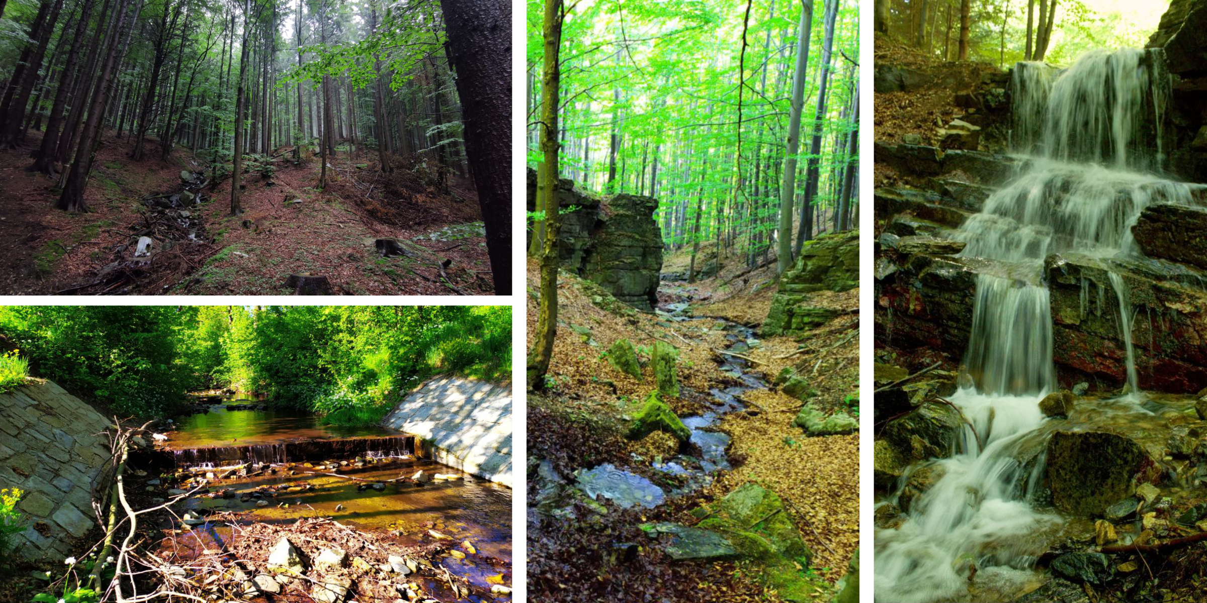
The trail starts at the Vápenná crossroads, from the signpost we will follow the Latzel’s trail (marked green) and continue along it for about 3km along the bed of the Stříbrný (= “Silver”) Brook.
Once the second forest road disconnects from the asphalt road, enter the riverbed and continue along the gorge. The path is slightly more difficult and uphill at first, but after about 300 metres through beautiful green countryside you will reach the jewel of this gorge – the waterfalls.
The Ztracený (= “Lost”) Waterfall is situated at an altitude of about 900 metres above sea level and has two equally high steps. The total height of the waterfall is about 3.5 metres. A series of cascades follows the waterfall and after a few metres a tributary joins with another series of cascades and a small waterfall. The Ztracený Waterfall itself was created by a boulder falling into the creek bed and pushing out the water flow.
If we continue on Ztracený Brook, we will encounter at least three more cascades and a tiny waterfall. The whole scenery is complemented by beautiful nature, dark green spruce and pine trees give the place a magical touch.
From the source of the Lost Stream, you can go back in two ways – either return to your destination along the green hiking trail, and on the way see the complex of caves Veliký dóm and Roušar’s Cave. This is an abandoned quarry with many caves, the longest of which is the Roušar’s Cave, which is about 300m long cave complex. The caves provide shelter for many bats, such as the lesser horseshoe bats, and also hide many beautiful stalactite decorations, but some stalactites have been damaged by quarrying. The Velký dóm (= “The Great Dome”), as the name suggests, is a 24x14m cave.
Another option of descent is to extend the trail up to Lví hora (= “Lion Mountain”), from where there are beautiful views of Javorník, The Rychlebské Mountains and The Hrubý Jeseník Mountains. The slopes are covered with light green beech trees and many valuable plants grow here. From Lví Hora, follow the ridge around Skála smrti (= “The Death Rock”). It is a 15 m high rock wall, carved with a relief of a rearing horse with a knight on its back and a girl falling from the rock. The relief is preceded by a legend – the miller’s girl, pursued by the evil knight, chose death by jumping from the high rock, but fortunately saved herself, while the knight fell down with his horse. The relief here was carved in 1910 by local artists.