
Map of the gorge
Location
Bělá pod Pradědem, Adolfovice
Navigation in Mapy.cz
Navigation in Mapy Google
Possible place of refreshment:
Jiří’s Chalet at Šerák Peak
Time: 6:40h
Ascent: 3:45h
Descent: 2:55h
Difficulty
Elevation difference: 920m
Discovered for rokling.cz by Průzkumníklára.
Trail description
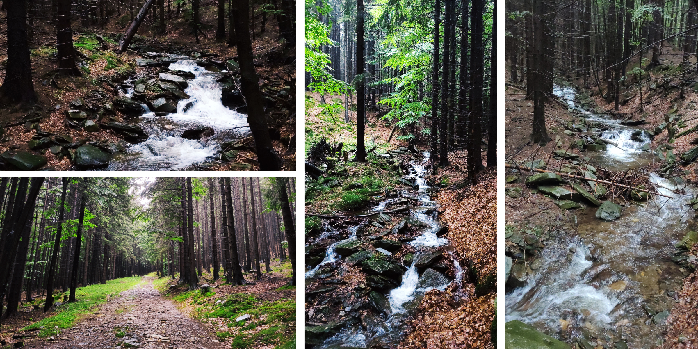
The route starts at the bus stop “Bělá pod Pradědem, Adolfovice”, where you can also park. Go about 2km along the asphalt road. Once you reach the crossroads “V Mlýnkách”, you can enter the gorge and continue along the riverbed up to the source of the Javořický brook, which will lead you to Šerák peak.
At the beginning the riverbed is wider and the water does not flow so fast, but as you gain altitude the stream becomes wilder, and you will see many waterfalls and cascades that the water forms. The Javořický brook is about 8km long and rises in the basin between the slopes of Šerák and Šumný peaks. The forest is mixed and provides pleasant shade on hot days, the moss-covered rocks and boulders give the place a special atmosphere and the rapids that the stream forms are a truly beautiful spectacle in places.
A little to the left of the Javořický brook there is the Šumárník nature reserve. It is situated on the rocky peak of Šumný at an altitude of 1073m above sea level and consists of an important botanical locality of a rock outcrop, the protected flowers here are the evergreen saxifraga, the Austrian buttercup and the green spleenwort. There are about 220 plant species registered here, 9 of which are highly endangered. Also worth mentioning is the rock marrow, which is a species of liverwort that closely resembles mosses. The Šumný peak is the only place in the Czech Republic where we can see the rock marrow.
Along the way you can meet many dams, which are built in the Jeseníky Mountains mainly to regulate water after rains and major storms.
The last part of the Javořický brook is very steep and it is better to miss the source of the Javořický brook and take the asphalt road instead. After that, you will reach the yellow hiking trail, which will lead you to the top of Šerák and you can look at the source of the stream from above. The top of Šerák and the source of the Javořický Brook are located in a national nature reserve and it is forbidden to walk outside the marked hiking trails – please observe this prohibition. At the top of Šerák you can refresh yourself in Jiří’s Chalet on Šerák, which offers not only refreshments but also accommodation.
For the descent route, follow the yellow hiking trail from Šerák to the finish.
Recommendation
Spare clothes and shoes are a must, the rocks are slippery and you can easily end up in the water. A snack is handy too, the journey is not entirely short.